This chart series serves the requirements of VFR in-flight navigation for low speed, short or medium range operations at low and intermediate altitudes. It is also used in pre-flight planning and for pilot and navigator training. Airspace information up to FL50 (5000 FT AMSL) and obstacles 328 FT AGL and above are depicted.
In addition to aeronautical information, the charts provide hydrographic, topographic, cultural and other visual features compatible with legibility at the scale of the chart – this information is supplied by GB Ordnance Survey and/or Ordnance Survey Northern Ireland. Terrain contours at intervals above 200 FT AMSL depicted. The charts show a more detailed topographical base than the 1:500,000 scale charts and are particularly well suited to the General Aviation community operating at low level.
Chart Amendments
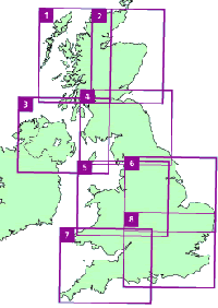
In order to view the published amendments on a current chart please select the chart you require either clicking on the map or selecting from the list below.
Sheet 1 - Northern Scotland West
Sheet 2 - Northern Scotland East
Sheet 5 - Central England & Wales
Sheet 7 - The West & South Wales
A4 Legend
You will find a printable version of the Legend here.