|
STANDARD INSTRUMENT DEPARTURE (SID) AND ARRIVAL ROUTES (STAR)
|
|
1
|
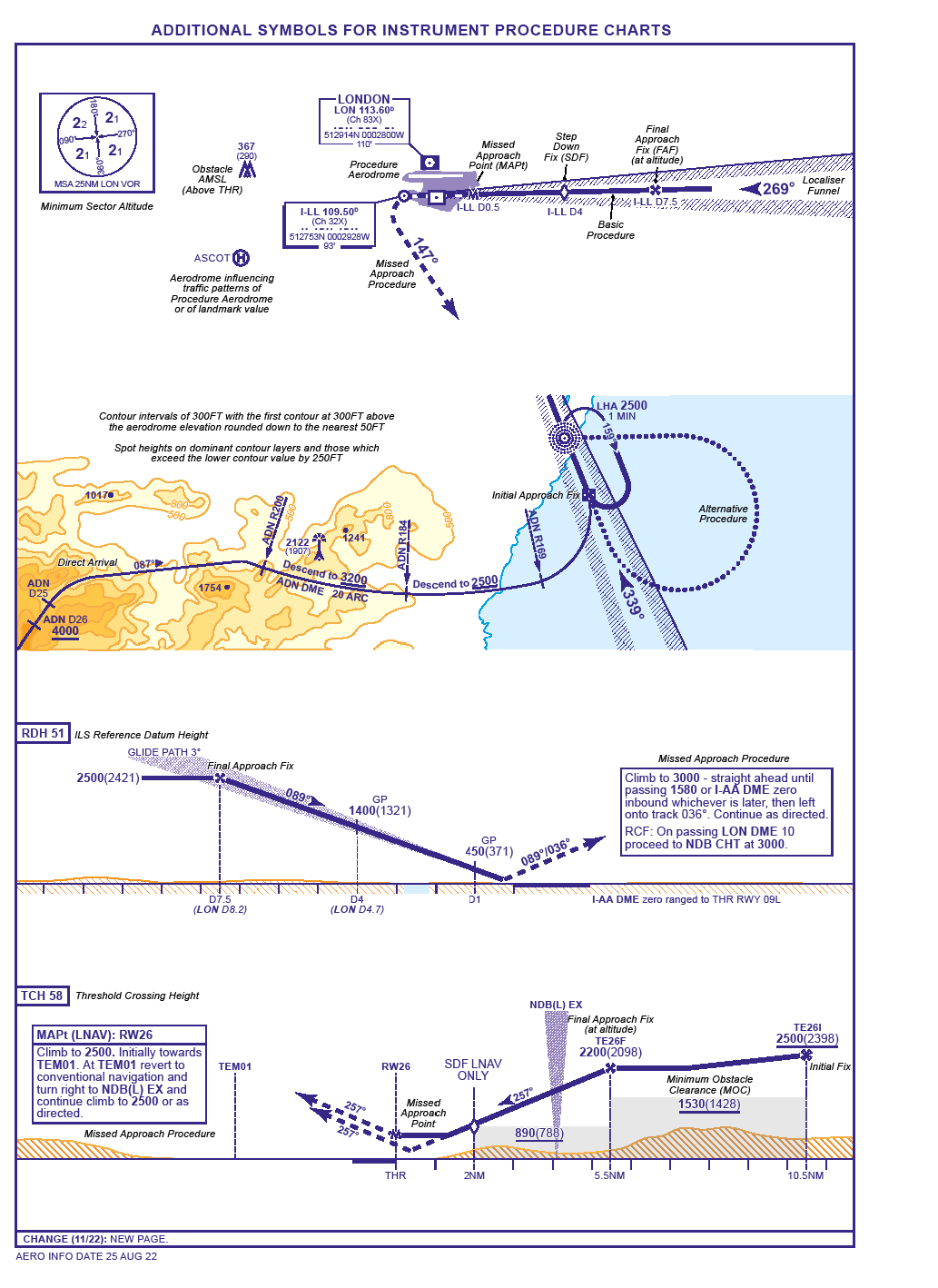
SID procedure charts are located in AD 2.
They consist of a textual description of the procedure, a graphical illustration and explanatory notes. Only aeronautical information pertinent to the procedure is shown and these charts should therefore be used together with a suitable En-route chart which gives details of Airspace Reservations, Controlled Airspace and ATS routes.
|
|
2
|
SID charts are arranged by Main Exit Points: the various runway directions which can be used to the relevant Main Exit Point will be found on one chart.
|
|
3
|
The procedure charts are drawn to scale.
Unless otherwise indicated:
-
Distances are in nautical miles;
-
Headings, bearings, tracks and radials are in degrees magnetic;
-
Heights/altitudes where stated are based on QFE/QNH;
-
Horizontal datum WGS 84 (CO-ORDS in DEG MIN SEC).
|
|
4
|
Area Minimum Altitude (AMA).
The lowest altitude to be used under instrument meteorological conditions (IMC) that will provide a minimum vertical clearance of 300M (1000FT) or in designated mountainous terrain 600M (2000FT) above all obstacles located in the area specified, rounded up to the nearest (next higher) 30M (100FT).
|
|
5
|
Net Climb Gradient.
The climb gradient, expressed as a percentage, that the aircraft is required to achieve to meet standard (ICAO PANS-OPS) obstacle clearance requirements, will be detailed in the textural description of the SID procedure when the required gradient is greater than 3.3% to be achieved. Procedure design gradients are annotated on charts as necessary. A table for conversion of percentage climb gradients to rates of climb for various speeds is given in the GEN 2.6 section.
|
|
6
|
Arrival Charts.
STARs or established inbound routes are shown in a similar fashion to SIDs. Tracks terminate at the main inbound holding point from which the Instrument Approach commences.
|